Brief description of the project
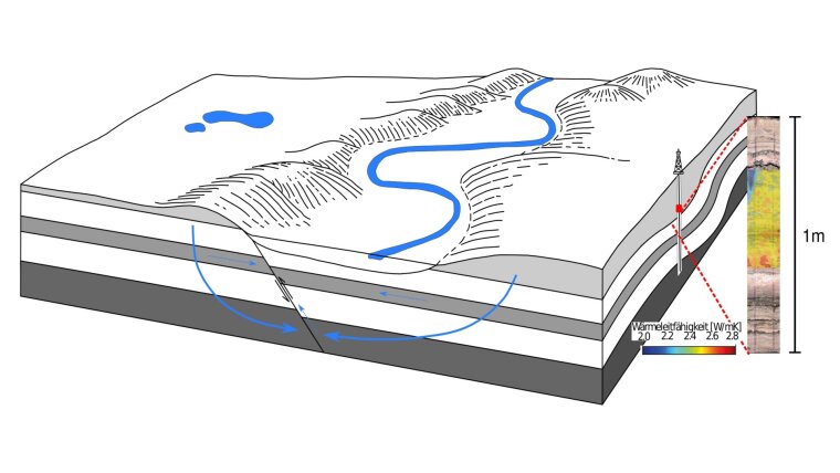
As part of the field of innovation ‘Understanding and Explaining Water’, the fundamental aim of ‘WaterSim’ is to visualize the process of natural water transport in the subsurface as well as the interaction with surface waters in order to assess volumes, fluid transport rates, and retention times of groundwater. To this end, ‘WaterSim’ conducts extensive numerical 4D simulations of the coupled fluid and heat transport in the area of the Saale valley. The valley lends itself brilliantly as an example because the geological formations found here are typical for large parts of Germany and Central Europe. Aside from the modelling of current and future scenarios, to build up a rock-physical database is an integral goal of ‘WaterSim’.
By using climate data as boundary conditions, the simulations take on a predictive character. In future project stages, this will allow to specifically visualize impacts of global change such as water scarcity or the consequences of extreme weather situations, which will create a basis for possible mitigation measures. In linking the thermohydraulic subsurface model developed in the framework of this project to the water system model of the ‘WaterLab’ project, ‘WaterSim’ contributes to extend citizens’ understanding of complex water cycles.


